Showcase Property Features From Above
Real Estate in Bakersfield for agents and sellers highlighting lot size, layout, and surrounding features to improve listing visibility
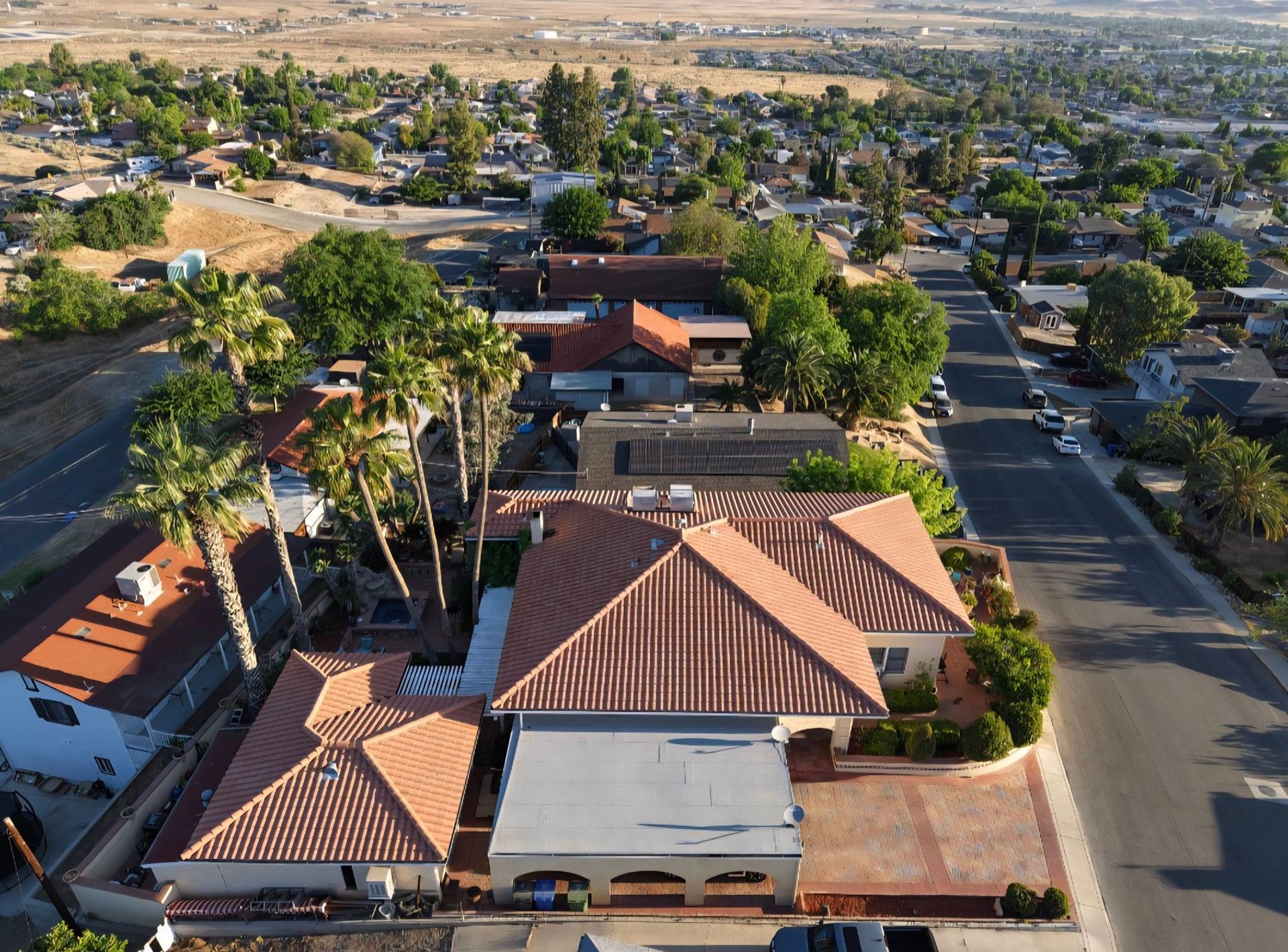
Larger properties, rural parcels, and homes with significant outdoor features often don't translate well in ground-level photos, leaving potential buyers uncertain about actual lot dimensions, backyard usability, or proximity to roads and neighbors. Aerial photography captures the full property footprint, showing how the home sits on the lot, where driveways and access points are located, and what the surrounding area looks like. This perspective helps buyers in Bakersfield and Kern County understand property context before scheduling a showing, especially when listings include acreage, outbuildings, or unique landscaping.
661 Aerial Ops provides aerial photos and video for residential and commercial property listings by flying planned routes that highlight the property's boundaries, improvements, and nearby features. The service includes multiple angles—overhead, oblique, and approach shots—that show the property's scale and relationship to streets, open land, or developments nearby. For rural properties, aerial visuals reveal details like irrigation systems, fencing, tree cover, and topography that are difficult to communicate with ground-level images alone.
Book a listing shoot to add aerial visuals that show your property's full layout and setting.
What Changes After Adding Aerial Visuals
Listings with aerial images give buyers a clear understanding of property size and layout before they visit, which reduces confusion and sets accurate expectations. The overhead view shows exactly how much yard space exists, where parking and access are located, and how the property connects to surrounding roads or open land. For homes on larger lots or in rural areas outside Bakersfield, this context is often the deciding factor in whether a buyer schedules a tour.
Once the aerial images are added to a listing, viewers can see the full property in one frame—something ground-level photos can't achieve. Agents report that these visuals reduce the number of unqualified showings, because buyers self-select based on accurate property representation. The images also work well in marketing materials, social media posts, and virtual tour packages, where showing the property's setting and scale quickly attracts the right audience.
The service includes both still images and short video clips, which can be edited into listing videos or used independently. Flights are coordinated around lighting conditions and scheduled to avoid high winds or poor visibility common in Kern County during certain times of year. Turnaround is typically within 48 hours, so listings can go live with complete visual packages shortly after the shoot.
Real estate agents, homeowners, and developers across Bakersfield frequently ask about how aerial photography fits into their listing strategy and what to expect on shoot day.
Answers to Frequent Service Questions
What time of day produces the best aerial images for listings?
Early morning or late afternoon light reduces harsh shadows and provides even illumination across the property, making structures and landscaping features more visible and appealing.
Can you capture video walkthroughs in addition to still images?
Yes, video clips showing approach views, overhead passes, and slow pans across the property are included and can be used in listing videos or social media promotions.
How does aerial photography help with rural or larger properties?
Aerial views show the full lot boundary, access routes, outbuildings, water features, and neighboring land use in a way that ground photos cannot, helping buyers visualize the property's true footprint and setting.
Are there restrictions on where you can fly for real estate shoots in Bakersfield?
Flights are conducted in compliance with airspace regulations, and most residential and rural properties in Bakersfield are accessible; properties near airports or restricted zones are reviewed individually before scheduling.
How quickly are the images delivered after the shoot?
Edited aerial images and video clips are typically delivered within 48 hours, formatted for immediate use in MLS listings, websites, and marketing materials.
661 Aerial Ops serves real estate professionals and property sellers throughout Bakersfield, Taft, Shafter, Wasco, Tehachapi, and Delano, providing aerial visuals that improve listing appeal and buyer understanding. Contact the service to arrange a shoot that highlights your property's layout and surrounding features.