Clear Views of Your Property Layout
Mapping and Survey Support in Bakersfield for landowners and planners needing quick visual reference of site conditions
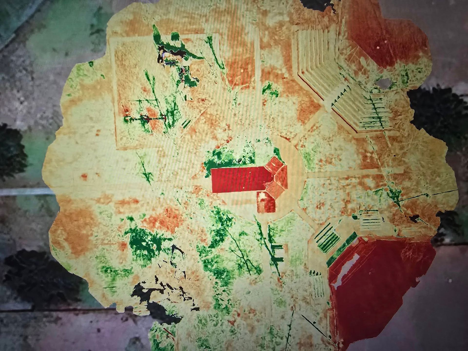
Agricultural properties, construction sites, and undeveloped parcels across Bakersfield and Kern County often lack current overhead imagery that reflects real-time conditions. 661 Aerial Ops provides drone-based aerial mapping to support surveying and engineering projects by delivering clear, high-resolution visuals of fence lines, irrigation layouts, access roads, structures, and terrain features in a single image. These maps are useful for planning, coordination, and communicating site conditions with surveyors, engineers, and contractors.
The process involves flying a planned route over your property to capture overlapping images, which are processed into an orthorectified map with accurate scale and orientation. The final output is a georeferenced image that can be viewed in standard software, printed, or used alongside survey data. In Kern County’s agricultural and semi-arid environments, these visuals clearly show field divisions, tree rows, dirt roads, and site features that may not appear on outdated satellite imagery.
Important: This service supports licensed surveyors and engineers by providing visual mapping data. It does not replace professional land surveying or establish legal boundaries.
Why Aerial Maps Work for General Site Understanding
Aerial mapping provides a cost-effective way to capture a complete overhead view of your property, supporting surveyors, engineers, and project teams without requiring extended field time. Each map is processed to remove distortion and maintain consistent scale, making it useful for general planning, estimating areas, and identifying access routes or existing site features alongside formal survey data.
Once complete, the imagery reveals details that are difficult to see from the ground—such as drainage patterns, property usage, vegetation growth, and how adjacent parcels connect. These maps are commonly used to support site planning, brief crews before mobilization, and help engineers and surveyors visualize conditions prior to or during their work. The added visual context improves communication and reduces uncertainty across project teams.
This service is designed to support—not replace—licensed land surveying, which is required for establishing legal boundaries, elevations, and certified measurements. Aerial maps act as a visual reference layer that complements professional survey data, helping streamline planning and coordination. Deliverables are provided in standard formats and can be used in CAD software or viewed on mobile devices in the field.
Landowners and project planners across Kern County frequently ask about how aerial mapping compares to other site documentation methods and what they can expect from the final product.
What Property Owners Usually Ask
What can you measure accurately from an aerial map?
Distances, areas, and angles can be measured from the orthorectified image with reasonable accuracy for planning purposes, though elevation data and legal boundary verification require a licensed surveyor.
How quickly can a map be delivered after the flight?
Most mapping projects are processed and delivered within three to five business days, depending on site size and image processing requirements.
What file formats are the maps provided in?
Maps are typically delivered as high-resolution JPEG or GeoTIFF files, which can be opened in image viewers, imported into CAD programs, or used in GIS software for further analysis.
Can you map large agricultural parcels in one flight?
Yes, flight plans are scaled to cover the full property boundary, and in Bakersfield's flat terrain, large parcels can be mapped efficiently without significant altitude or perspective limitations.
What's the difference between this and free satellite imagery?
Aerial maps are captured on-demand with higher resolution and more recent conditions than satellite services, showing current ground features, equipment, and vegetation that may have changed since the last satellite pass.
661 Aerial Ops has mapped agricultural land, construction sites, and undeveloped parcels throughout Bakersfield and Kern County, providing landowners with visual references that support planning and communication. Contact the team to discuss your property size and mapping needs for a tailored flight plan.